American Manganese Inc. Acquires Phosphate Claims in Elk Valley, Southeastern BC
February 26 2014 - 5:00AM
Marketwired Canada
Larry W. Reaugh, President and Chief Executive Officer of American Manganese
Inc. ("American Manganese" or the "Company") (TSX
VENTURE:AMY)(PINKSHEETS:AMYZF)(FRANKFURT:2AM), is pleased to report that the
Company has acquired by staking two claim blocks totaling 1581.21 hectares
(3906.38 acres) in the Ft. Steele Mining Division, located 11.5 km north of
Sparwood, BC. Mr. Reaugh states, "The acquisition of this phosphate project
follows the Company's philosophy of finding superior value in non-mainstream
mineral projects in politically stable and mining-friendly jurisdictions through
the application of state-of-the-art mineral science."


The claim blocks, historically known as "Line Creek/Mount Lyne" and "Fording
River" respectively, are 3.5 km apart and are easily accessible from existing
roads and highway. Furthermore, a CP Rail line runs through the Fording River
claims.


Ministry of Employment and Investment Bulletin 98 titled "Phosphate deposits in
British Columbia" by S. Butrenchuck (1996); describes the properties and the
work performed by Cominco Ltd. and Crows Nest Resources Limited during the
mid-1970s. This work included some diamond drilling, track dozer/back hoe/hand
surface trenching, and a 12 meter adit. From this report:


--  General Geology: "Triassic strata are unconformably overlain by dark
    grey to black shale, phosphate and minor limestone, siltstone and
    sandstone of the Jurassic Fernie Formation (Freebold1957, 1969). In
    southeastern British Columbia this formation occupies a broad canoe-
    shaped synclinal structure covering an area of 2000 square kilometers
    and attains thicknesses of 70 and 376 meters with a general thickening
    westward. A persistent pelletal phosphorite bed, 1 to 2 meters thick and
    containing greater than 15% P2O5 was deposited in a transgressive
    sequence at the base of the Fernie Formation in strata of Sinemurian
    age. It rests either directly Triassic strata or is separated from the
    underlying rocks by a thin phosphatic conglomerate. The phosphatic
    interval may also be represented by two phosphate beds separated by
    phosphatic shale. Thicknesses in excess of 2 meters are attained
    locally, as at Mount Lyne where 4 meters of phosphate rock are present.
    Phosphatic shales of variable thickness, generally less than 3 meters,
    overlie the phosphate. The top of this sequence is sometimes marked by a
    yellowish orange calcareous bed 2 to 5 centimeters thick. Thin marcasite
    bed may be present locally within the phosphatic interval."


--  Line Creek/Mount Lyne (977.41 hectares or 2415.80 acres): "In the west
    Line Creek area the basal phosphate can be traced for a strike length of
    15 kilometers, in strata that dip 40 to 75 degrees easterly. It varies
    in thickness from less than 1 meter south of west Line Creek, to more
    than 3 meters at Mount Lyne. Phosphate content ranges from a low of 3.7%
    P2O5 in a diamond drill hole to a high of 23.71% P2O5 across 1.6 meters
    in a back hoe trench." The test results include:


    --  19.5% P2O5 over 1.75 meters in a track dozer trench cut on the north
        end of the property.

    --  19.5% P2O5 over 1.75 meters in a hand trench cut about 1 kilometer
        south of the aforesaid track dozer trench.

    --  23.71% over 1.6 meters in a back hoe trench cut about 2 kilometers
        south of the aforesaid track dozer trench.

    --  3.70% P2O5 over 0.50 meters in a diamond drill hole sited about 6
        kilometers south of the aforesaid track dozer trench.

    --  On ground not owned by Company, 23.2% P2O5 over 2 meters was sampled
        at site about 2 kilometers north of the aforesaid track dozer
        trench.


--  Fording River (603.82 hectares or 1491.20 acres): "The Fording River
    phosphate occurrence, which has been known for a number of years, has
    been explored by Crows Nest Resources Limited and Cominco Ltd. The work
    by Cominco included diamond drilling, mapping, trenching and a 12 meter
    adit." The test results from Cominco Ltd. assessment reports 5545, 5866,
    and 5867 include:


    --  16.93% P2O5 over 1.5 meters in diamond drill hole 75-1 located
        southwest of Grave Lake in the southern portion of the claim block.

    --  18.57% P2O5 over 1.76 meters in diamond drill hole 75-5 located
        about 8 kilometers north of diamond drill hole 75-1.

    --  21.30% P2O5 over 1.20 meters from the face of a 12 meter adit
        located about 1 kilometer southeast of diamond drill hole 75-5.


A suitable means of mineral processing is required to yield a concentrate
grading 30% P2O5 with acceptable mineral recovery. Previous test work is more
than 40 years old, and does not reflect advances in reagents and mineral
processing technologies. As known phosphate deposits become depleted, the need
for new mining and extraction methods continues to grow. The Company plans to
investigate and apply the latest scientific advances in phosphate beneficiation
to confirm the previous work and improve the results.


According to the USGS (2013) world mine production increased from 198 million
tonnes in 2011 to 210 million tonnes in 2012. The United States is the world's
second largest phosphate producer, and phosphate mining represents the fifth
largest mining industry in the United States. More than 95% of the U.S.
phosphate rock mined is used to manufacture wet process phosphoric acid and
superphosphoric acid, which are then used as intermediate feed stocks in the
manufacture of granular and liquid ammonium phosphate fertilizers and animal
feed supplements. Phosphorus is an essential ingredient in agriculture, for
which there are no substitutes.


All of the historical estimates mentioned above may not be compliant with
National Instrument 43-101 and should not be relied upon. A qualified person has
not done sufficient work to classify the historical estimates as current mineral
resources or mineral reserves and the Company is not treating the historical
estimates as current mineral resources or mineral reserves.


About American Manganese Inc.

American Manganese Inc. is a diversified specialty and critical metal Company
focusing on potentially becoming the lowest cost producer of electrolytic
manganese metal from its Arizona Manganese Project.


This release has been reviewed by Michael MacLeod, PEng, a qualified person
pursuant to National Instrument 43-101.


On behalf of Management, AMERICAN MANGANESE INC.

Larry W. Reaugh, President and Chief Executive Officer

The TSX-Venture Exchange has not reviewed and does not accept responsibility for
the adequacy or accuracy of this release. This news release may contain certain
"Forward-Looking Statements" within the meaning of Section 21E of the United
States Securities Exchange Act of 1934, as amended. All statements, other than
statements of historical fact, included herein are forward-looking statements
that involve various risks and uncertainties. There can be no assurance that
such statements will prove to be accurate, and actual results and future events
could differ materially from those anticipated in such statements. Important
factors that could cause actual results to differ materially from the Company's
expectations are disclosed in the Company's documents filed from time to time
with the TSX-Venture Exchange, the British Columbia Securities Commission and
the US Securities and Exchange Commission.


FOR FURTHER INFORMATION PLEASE CONTACT:
American Manganese Inc.
Larry W. Reaugh
President and Chief Executive Officer
604-531-9639


American Manganese Inc.
Connie Fischer
Investor Relations
604-531-9639 ext. 110
connieir@amymn.com or info@amymn.com
www.americanmanganeseinc.com
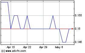
Recylico Battery Materials (TSXV:AMY)
Historical Stock Chart
From Apr 2024 to May 2024

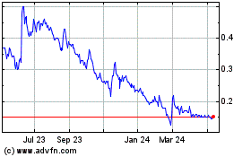
Recylico Battery Materials (TSXV:AMY)
Historical Stock Chart
From May 2023 to May 2024
