International Frontier Resources Corporation: First Quarter 2012 Results
May 29 2012 - 12:58PM
Marketwired Canada
International Frontier Resources Corporation (TSX VENTURE:IFR) ("the Company")
today released results for the period ending March 31, 2012. In the period the
Company recorded a net loss of $53,675 ($0.001 per share) versus a net loss of
$132,955 in Q1, 2011. Revenue, net of royalties, was $229,850 compared with
$132,040 in Q1, 2011. At March 31, 2012 cash and cash equivalents were
$3,991,000 and working capital was $3,014,555.


The Company's project areas are located in N.W. Montana (Southern Alberta Basin
tight-oil-plays) and in the Central Mackenzie Valley, NWT. A summary of industry
activity in the period is as follows.


N.W. Montana


----------------------------------------------------------------------------
Glacier County  Well Location            Permit       Depth      Projected
Operator                                 Date         Feet       Zone
----------------------------------------------------------------------------
Newfield        Anderson 1-10-37-10      19/1/12      12,381     Bakken
----------------------------------------------------------------------------
Rosetta         Fort Peigan 16-13-34-8   31/1/12      9,976      Bakken
----------------------------------------------------------------------------
Anschutz        Whitecalf 2-4- 30-10     3/2/12       8,120      Sun River
----------------------------------------------------------------------------
Anschutz        Flat Iron 1-8-32-12      21/2/12      8,900      Blackleaf
----------------------------------------------------------------------------
Rosetta         Little Rock Coulee 27-16-
                35-7                     28/2/12      9,185      Bakken
----------------------------------------------------------------------------
Anschutz        Pine Ridge 1-4-37-13     2/4/12       11,023     Potlach
----------------------------------------------------------------------------
Anschutz        Mallard 1-14-33-12       17/4/12      10,500     Cretaceous
----------------------------------------------------------------------------
Rosetta         Little Rock Coulee 13-18-
                35-7                     17/5/12      9,856      Bakken
----------------------------------------------------------------------------
Teton County
----------------------------------------------------------------------------
Primary         Rockport 16-19-27-6      24/5/12      9,067      Potlach
----------------------------------------------------------------------------
Primary         Spring Hill 14-34-27-6   24/5/12      8,216      Potlach
----------------------------------------------------------------------------

-------------------------------------------------
Glacier County  Proximity  Well       Status
Operator        IFR land   Direction  May 2012
-------------------------------------------------
Newfield        1.8 miles  Horizontal Location
-------------------------------------------------
Rosetta         .75 miles  Horizontal Location
-------------------------------------------------
Anschutz        .75 miles  Horizontal Location
-------------------------------------------------
Anschutz        2 miles    Vertical   Drilling
-------------------------------------------------
Rosetta         3 miles    Horizontal Drilling
-------------------------------------------------
Anschutz        1.2 miles  Vertical   Drilled
-------------------------------------------------
Anschutz        1.6 miles  Horizontal Drilled
-------------------------------------------------
Rosetta         .5 miles   Horizontal Location
-------------------------------------------------
Teton County
-------------------------------------------------
Primary         .5 miles   Horizontal Drilling
-------------------------------------------------
Primary         .75 miles  Horizontal Location
-------------------------------------------------


Source: Montana State web site

SW Alberta


----------------------------------------------------------------------------
Operator       Wells W4M   License Depth  Projected   Well        North of
                           Date    Meters Zone        Direction   border
----------------------------------------------------------------------------
Connaught      13-8-1-21   24/1/12 3,014  Rundle      Horizontal  2 miles
----------------------------------------------------------------------------
Crescent Pt.   13-11-2-20  3/2/12  2,900  Wabamun     Horizontal  8 miles
----------------------------------------------------------------------------
DeeThree       5-22-3-17   24/2/12 5,055  Bakken      Horizontal  16 miles
----------------------------------------------------------------------------
Shell          13-3-1-23   24/2/12 3,919  Wabamun     Horizontal  1 mile
----------------------------------------------------------------------------
Crescent Pt.   13-24-2-21  1/3/12  4,000  Wabamun     Horizontal  10 miles
----------------------------------------------------------------------------
DeeThree       13-22-3-17  15/3/12 4,305  Bakken      Horizontal  17 miles
----------------------------------------------------------------------------
Gryphon        3-12-1-20   17/4/12 2,100  Livingston  Horizontal  2 miles
----------------------------------------------------------------------------
DeeThree       11-12-3-18  15/6/12 4,230  Big Valley  Horizontal  14 miles
----------------------------------------------------------------------------


Source: Daily Oil Bulletin

Well Test Rates (Initial Production Rate)


-----------------------------------------------------------
                              Initial
Montana           Operator    Rate       Days
-----------------------------------------------------------
Riverbend 12-13H  Rosetta     403 BOEPD  Not reported
-----------------------------------------------------------
Riverbend 7- 4H   Rosetta     154 BOEPD  Not reported
-----------------------------------------------------------
Simonson 34-1H    Rosetta     104 BOEPD  Not reported
-----------------------------------------------------------
SW Alta
-----------------------------------------------------------
Loc #1            DeeThree    765 BOPD   4
-----------------------------------------------------------
Loc #2            DeeThree    957 BOPD   6
-----------------------------------------------------------
Loc #3            DeeThree    940 BOPD   10
-----------------------------------------------------------
Loc #4            DeeThree    960 BOPD   5
-----------------------------------------------------------
Kainai 15-21      Murphy      350 BOPD   Not reported
-----------------------------------------------------------


Source - Corporate presentations and news releases

Upon closing the two previously announced purchase and sale agreements the
Company will own mineral titles covering approximately 20,000 gross acres,
17,400 net acres in N.W. Montana. The fee acreage is located on the Blackfeet
Reserve (95%) in Glacier County, and in Teton County (5%). To date operators
have permitted 52 exploration wells to evaluate the resource potential in
various tight-oil formations on the play. The Blackfeet Reserve covers an area
of approximately 1.5 million acres and is host to a number of prospective
reservoir targets. The Company's fee acreage portfolio is spread-out as to
one-third located in the west, central and eastern portions of the Reserve.


In Q1, 2012 Husky Oil completed drilling two vertical pilot wells to evaluate
the resource potential in the Canol shale formation in the Tulita area of the
Central Mackenzie Valley, NWT. In April two seismic surveys were completed in
the area; Husky recorded a 744-kilometer 3D seismic survey and Explor
Geophysical shot a 480-kilometer 2D survey. The Company holds an interest in
three Significant Discovery Licenses and three freehold parcels located south of
the activity in the Tulita area.


The Company's financial statements, related management discussion and analysis
for the period have been filed on Sedar, copies will be posted on the Company's
website at www.internationalfrontier.com


Pat Boswell, President

This news release includes forward- looking statements and provides third party
information for which the Company seeks Safe Harbor.
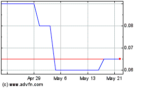
International Frontier R... (TSXV:IFR)
Historical Stock Chart
From Apr 2024 to May 2024

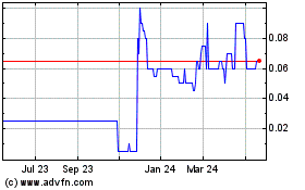
International Frontier R... (TSXV:IFR)
Historical Stock Chart
From May 2023 to May 2024
